
Proprietary Data Layers for Acquisition
Data Layer Pricing
Purpose-built GIS layers from Mineralocity's national aggregate intelligence platform. Available for one-time acquisition or annual refresh, formatted and ready for your internal GIS environment.
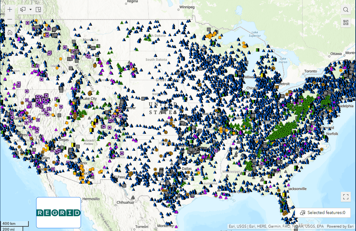
10,000+
Mine Locations
All 50
States Covered
2020–Now
Production History
Annual
Refresh Available
Available Layers
Five layers. Every dataset you need.
L-01
Producers
Comprehensive nationwide layer covering all active aggregate production sites. Includes annual production tonnage estimates from 2020 to present, commodity type, operator and parent company information, and verified contact details for current site operators.
$9,500
All 50 States
L-02
Sales Yards
Nationwide layer mapping all marine and rail aggregate resale yards — the critical distribution infrastructure connecting production sites to end markets. Essential for logistics modeling, distribution planning, and supply chain analysis.
$2,000
All 50 States
L-03
Geology
Nationwide geologic layer intersected with real-world aggregate production data. Shows estimated production tonnage by geologic formation, enabling identification of high-potential formations for quarry development, site screening, and resource evaluation.
$1,500
All 50 States
L-04
Cement Plants & Terminals
Complete nationwide layer of all active cement production facilities and distribution terminals. Critical infrastructure data for understanding downstream demand, distribution reach, and regional supply chain structure. Contact information is coming soon.
$1,500
All 50 States
L-05
Aggregate Consumers
State-level maps of all active concrete batch plants and asphalt plants — the primary end-market consumers of construction aggregates. Indispensable for demand modeling, sales territory analysis, and identifying underserved markets.
$1,000 to $2,500
Per State
(Tiered depending on state size and facility density)
Complete Core Layer Package
Includes: Layers 1 through 4 (Producers, Sales Yards, Geology, and Cement Plants & Terminals).
$12,500
Savings of $2,000
DATA CENTER APPLICATIONS
Built for large-scale construction intelligence
These layers are directly applicable to data center site selection and construction materials planning. Combined with the Burgex PASS-DC report, they give development teams a complete picture of aggregate supply adequacy, competitive producer landscape, and downstream infrastructure — before a site commitment is made.
- ProducersSupply mapping
- GeologySite screening
- ConsumersDemand context
- CementInfrastructure reach
How It Works
Formatted for your environment.
One-Time Acquisition
Purchase layers as a standardized, high-fidelity dataset ready for your internal GIS platform. No ongoing subscription required.
Annual Data Refresh
Keep your internal models current with low-cost annual updates to production estimates, operator info, and plant locations.
GIS-Ready Format
Layers delivered pre-formatted and standardized for direct import into your GIS environment. Spend time on analysis, not data wrangling.
Buy What You Need
Acquire individual layers or the full dataset. Consumer layers available on a state-by-state basis. Enterprise arrangements available.